Is Marble Hill part of the Bronx or Manhattan? Read the fascinating history behind one of New York's most important infrastructure projects, and how it caused a dispute that's lasted over 100 years.
If you look at a contemporary map, modern day Marble Hill is quite nicely nestled into the Bronx and looks like it has always been so:
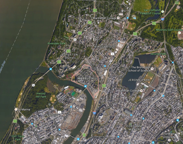
But politically and officially, it's still a part of New York County and is Manhattan's only neighborhood in mainland North America - that's because it actually was a part of Manhattan Island, once upon a time.
But things got complicated.
This geographic curiosity was caused by a massive and influential infrastructure project at the end of the 19th century and is the source of continued controversy about the neighborhood's proper borough.
The Original Marble Hill
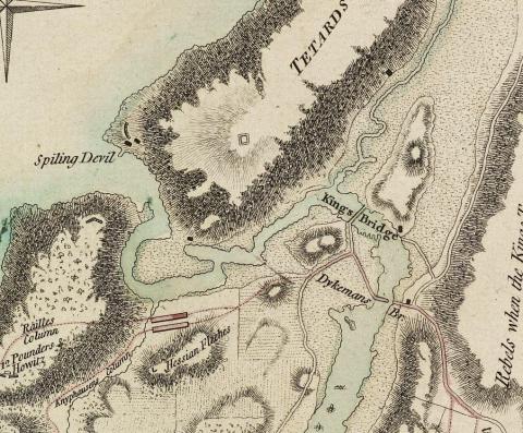
Marble Hill has been occupied since Dutch colonial times. During the American Revolution, it served as an important strategic lookout, where observers could use its elevation to keep an eye on tactically important bridges of northern Manhattan (George Washington and his troops retreated across these bridges after The Battle of Harlem Heights).
This 18th-century map shows the original geography of northern Manhattan - notably less straightforward than it is today:
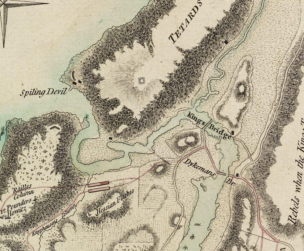
Here, Marble Hill is a part of Manhattan - the body of water wrapping around it is the Spuyten Duyvil Creek. Spuyten Duyvil Creek is a small estuary that connects the Hudson River to the northernmost portion of the Harlem River.
The creek is shallow, rocky and not navigable for large ships, even at high tide. Though work was undertaken to make it easier for small and medium-sized ships to move through, it was simply not possible for large steam ships to traverse.
As the Erie Canal opened up the shipping industry for upstate New York and beyond, more ships needed to get from the Hudson River out to the Long Island Sound (and vice versa) - if only they could fit through the Spuyten Duyvil Creek, valuable time and money wouldn't be lost by sending them around the southern tip of Manhattan.
May 17th, 1896 article in the New York Times.
The Lonely Island
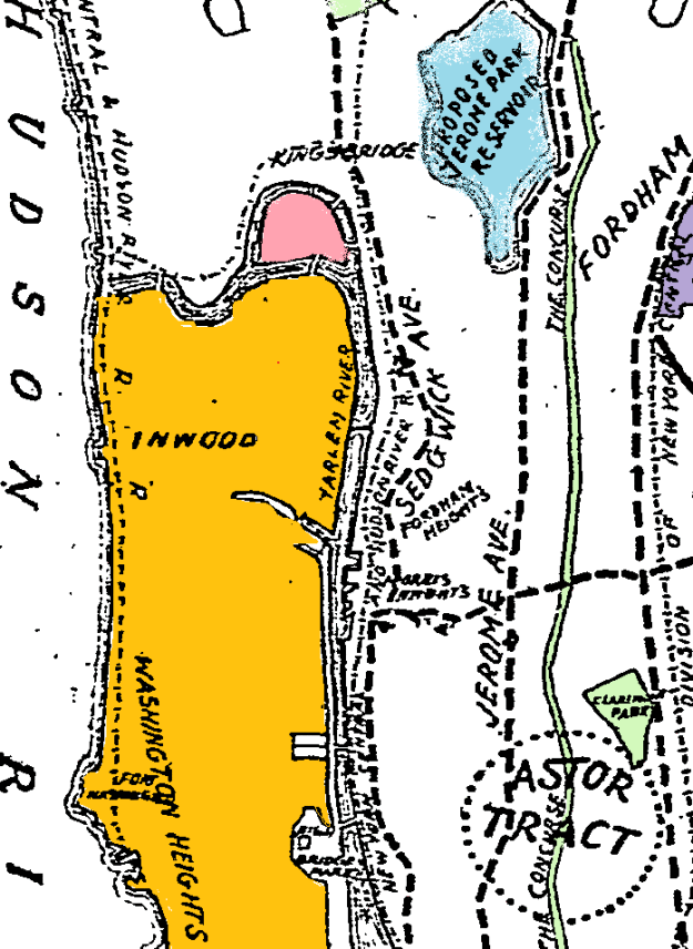
In 1895, New York finally took action - the construction of the Harlem Ship Canal would separate Marble Hill from Manhattan by creating a new waterway along the neighborhood's southern border.
The project, like many in the area at the time, drew German and Irish immigrants, many of which settled around Marble Hill.
The map on the right is from an 1896 issue of the New York Times and shows how it looked right after the Canal's construction.
The portion of Spuyten Duyvil Creek north of Marble Hill remained, and the canal on its newly-created southern shore worked wonders for the shipping industry by significantly shortening the route between the Hudson River and the Long Island Sound.
Marble Hill was now an island, but only for a brief time - in 1914, the water on the north side of the hill was filled in, permanently connecting it to the Bronx.
If you're curious to see the location of the old waterway, head over to St. Stephen's Church - located at the base of the hill, it used to overlook the Spuyten Duyvil Creek.
New York Times article
Borough Envy
One thing that has not changed about Marble Hill is its status as a part of New York County, though it has been the subject of debate ever since it was physically linked with the Bronx over 100 years ago.
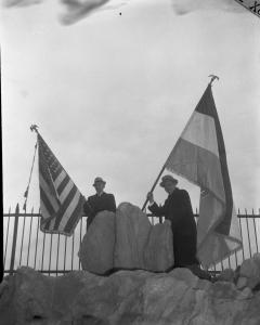
In 1939, Bronx Borough President James J, Lyons "annexed" Marble Hill in a poorly thought-out publicity stunt.
He drove over the border and planted both the flag of the United States and of Bronx County firmly on a neighborhood rock formation, declaring "In the name of the Bronx, of which I am the President, I hereby proclaim this territory of Marble Hill to be part of my borough."
Local residents were not amused, and the New York Times compared Lyons to another public figure who had been making headlines for brash, unilateral land-grabs in 1939.
The issue was finally laid to rest in 1984 after a controversial court decision that confused the neighborhood's standing caused the issue to come back into focus.
It was eventually settled when the New York Legislature voted to permanently include Marble Hill as a part of Manhattan.
More Genealogy Reading
-
New York State Vital Records Guide
-
New York State Census Records Online
-
Surprising Facts About Immigration to New York
-
New Records: Shipwrecked Passengers to America, 1817 - 1875
-
Historical New York Maps for Genealogy Research
About the New York Genealogical and Biographical Society
a registered 501(c)(3) organization devoted to
preserving, documenting, and sharing the history of
New York State families. Read more about our mission.
Since 1869, our mission has been to help our thousands of worldwide members discover their family's New York story, and there has never been a better time to join.
The cost of an Individual Annual Membership is less than six dollars a month, and includes the following benefits:
- Access to over 50 exclusive digital record sets covering the entire state of New York, including the fully searchable archives of The Record.
- A complimentary subscription to all of Findmypast's North American records, as well as U.K. and Irish Census records.
- Access to hundreds of expert-authored Knowledge Base articles and webinars to help you navigate the tricky New York research landscape.
- Exclusive discounts and advanced access to conferences, seminars, workshops and lectures to learn more about researching people and places across New York State.
To learn more or join us, please visit our member benefits page.